The Şehir Hatları ferry from Kabataş to Burgazada costs 151.23 TL on an Istanbulkart in 2026 and takes 55 to 70 minutes. From the pier, you walk through the village square to the Sait Faik Abasıyanık Museum on Çayır Sokak, which is free to enter and open Wednesday through Sunday. Buy water bottles at the pier grocer before starting your ascent; shops disappear entirely once you climb toward Hristos Monastery. You can follow the coastal path past Madam Martha Bay toward Kalpazankaya for sunset. If you plan to dine at Kalpazankaya restaurant, reserve a table well in advance, or enjoy the open cliff rocks nearby. For late returns, check the posted Bostancı boat times or catch the evening Şehir Hatları ferries back to the mainland.
At 08:40 on a weekday at the Kabataş ferry terminal, tapping an Istanbulkart costs 151.23 TL (€3.02) for the public run to the Princes Islands Istanbul. Most visitors stay on board until the final dock at Büyükada, where long lines for municipal electric shuttles and packed waterfront souvenir stalls dominate the morning. Stepping off two stops earlier at Burgazada leaves you on a quiet stone pier with the smell of pine needles and open water.
Burgazada is the third largest island in the archipelago, yet it remains relatively sheltered from mass tourism. The island centers on pedestrian lanes, historic wooden mansions, and the legacy of short-story writer Sait Faik Abasıyanık, whose preserved residence sits halfway up the hillside. A rewarding Burgazada walking route takes you past Greek Orthodox chapels, up through reforested ridge trails toward Bayraktepe, and down to the steep cliffs of Kalpazankaya.
Insider tip: The most common logistics mistake I see visitors make is arriving on a Monday or Tuesday expecting to visit the Sait Faik Museum. The Darüşşafaka Society maintains the restored villa open Wednesday through Sunday from 10:00 to 19:00 with free admission. If you arrive on the wrong day, the heavy iron gate remains locked, and you miss the central cultural piece of the island.
Because Burgazada prohibits private cars and operates only a handful of shared municipal electric minibuses, exploring here depends entirely on comfortable walking shoes and the boat schedule. Solid Istanbul island ferry tips start with knowing how to balance the leisurely outdoor decks of the public Şehir Hatları vessels against faster private operators like Mavi Marmara, especially when afternoon southwesterly winds begin to disturb the Marmara Sea.
Ferry connections and boarding tips for Burgazada in 2026
Getting to Burgazada requires crossing the Marmara Sea from either the European or Asian waterfront using public ferries or licensed private motorboats. Departures run throughout the day from Kabatas Ferry Terminal and Kadikoy Pier on the municipal Şehir Hatları network, while private operators like Mavi Marmara and Turyol operate services from Bostanci Pier and Kabataş. If you are connecting from Taksim down to the European docks, review the transfer connections in our overview of Beyoğlu funicular and nostalgic tram routes with 2026 boarding tips to coordinate your travel time before morning ferry gates close.
Every passenger must tap a contactless card or scan an Istanbulkart at the turnstiles before stepping onto the gangway. Municipal ferry boarding is 151.23 TL (3.02 EUR / 3.36 USD) with Istanbulkart, while private motorboats cost 151.23 TL (3.02 EUR / 3.36 USD). Ticket machines stand outside every terminal entrance, but long queues collect quickly on weekend mornings. You should top up your card at a transit station prior to reaching the waterfront to bypass the kiosks.
Field Anecdote: On my visit to Kabataş on a clear Friday morning at 08:35, I arrived with an unvalidated Istanbulkart and saw a 30-person queue jammed in front of the two working ticket kiosks. By the time I loaded 200 TL, the 08:45 ferry horn blew, and I missed the boat by forty seconds. That taught me to always top up at a metro turnstile the evening before rather than counting on waterfront terminals.
Insider tip: On summer mornings at Kabataş Ferry Terminal, crowds rush the gates the moment boarding begins. I position myself at the turnstiles 20 minutes before departure. Once onboard, I head directly up to the starboard exterior benches; this keeps you under the deck shade while giving you open views of the Historical Peninsula as the boat pulls away.
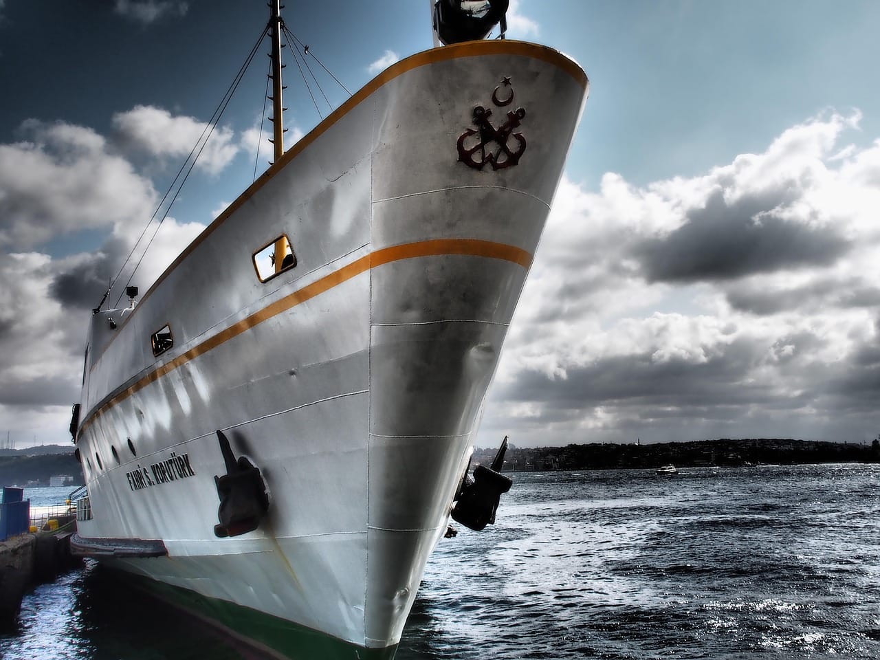
Private carriers like Mavi Marmara operate smaller, faster double-deck boats out of Bostancı, which cut total water transit time down to roughly 30 minutes. The municipal Şehir Hatları vessels provide wider outdoor decks, indoor tea lounges, and greater stability during rough chop, but their routes stop at Kınalıada first before docking at Burgazada.
| Departure Pier | Operator | Average Transit Time | One-Way Fare |
|---|---|---|---|
| Kabatas Ferry Terminal | Şehir Hatları | 70 minutes | 151.23 TL (3.02 EUR / 3.36 USD) |
| Kadikoy Pier | Şehir Hatları | 45 minutes | 151.23 TL (3.02 EUR / 3.36 USD) |
| Bostanci Pier | Mavi Marmara | 30 minutes | 151.23 TL (3.02 EUR / 3.36 USD) |
| Kabatas Ferry Terminal | Turyol | 55 minutes | 151.23 TL (3.02 EUR / 3.36 USD) |
Return services back to the city thin out considerably after sunset, particularly from September through May. You should read the physical schedule posted on the dock immediately upon arrival at Burgazada, as strong southwesterly winds can cause evening cancelations. The final municipal ferry back toward Kadıköy and Kabataş leaves Burgazada at 21:15 on weekdays.
Arrival at Burgazada pier and orientation through the village square
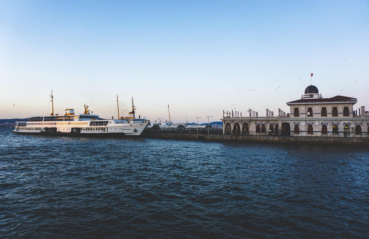
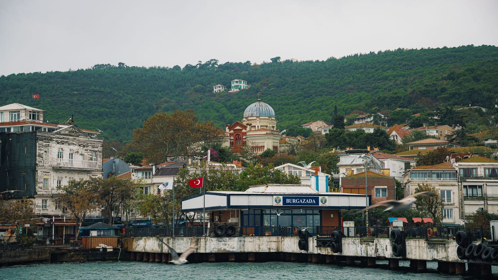
Ferries dock at the arched, tile-accented terminal of Burgazada Pier, delivering passengers directly onto the flat stone waterfront without car traffic. Exiting the dock brings you onto Gezi Caddesi, where tea gardens face the Marmara Sea and small wooden fishing skiffs sit along the concrete breakwater. The village layout radiates outward from this waterfront concourse. Much like the preserved historic domestic architecture highlighted in our Kuzguncuk Walking Tour: Istanbul, Burgazada maintains a compact scale where residential lanes and local trade meet right at the shoreline.
Directly across from the square stands Ergun Pastanesi, operating in this location since the early 1980s. Before setting out on your Burgazada walking route, stop here for baked goods. The display cases carry savory açma, potato rolls, and their standard fruit milföy pastry priced at 330 TL (6.60 EUR / 7.33 USD), alongside house-made sour cherry liqueur chocolates sold in boxed sets. Outdoor tables sit beneath the canopy, though the counter staff can wrap items quickly if you prefer to eat while walking.
Insider tip: I always aim for the 08:45 ferry so I can sit outside at Ergun before the day-tripper crowds fill the terrace. Order the sour cherry milföy with a glass of black tea, but turn the pastry on its side before cutting into it; slicing from the top crushes the cream out and shatters the crust into crumbs.
Just past the bakery, the central square marks the terminal stop for Adabus electric transit. These small municipality vehicles run circular loops along the outer ring road toward Kalpazankaya. However, Burgazada measures barely two square kilometers, making the entire territory accessible on foot without waiting for a scheduled departure. To continue inland, the main pedestrian street branches upward to the right of the square, where cobblestones lead past timber houses toward the pine ridges.
The Sait Faik Abasiyanik Museum on Cayir Sokak
A five-minute uphill walk from the Burgazada ferry pier brings you to Çayır Sokak No: 15, where a crisp white four-story timber residence stands behind a wrought-iron gate. This house belonged to the family of Sait Faik Abasıyanık, the modernist writer whose work reshaped twentieth-century Turkish modern literature. While living here during the 1940s and early 1950s, he produced spare, conversational prose chronicling everyday island life: Greek and Turkish fishermen mending nets along the quay, local street vendors, stray dogs, and ordinary workers on the water.
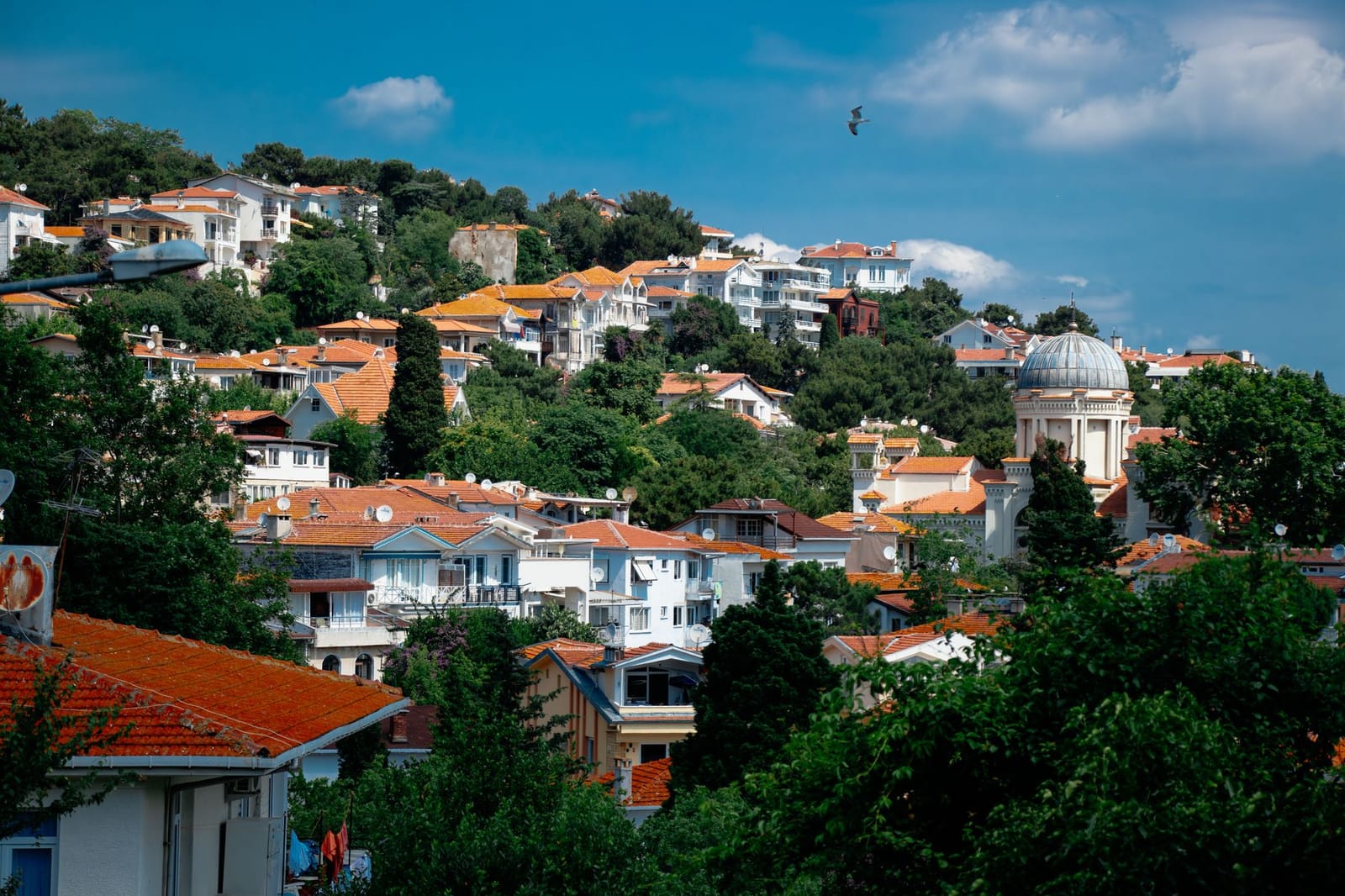
The museum charges no entrance fee, funded and managed entirely by the Darüşşafaka Society in accordance with the will of the author’s mother, Makbule Hanım. It opens Wednesday through Sunday from 10:00 to 17:00, staying closed on Mondays and Tuesdays. Looking down the slope from the entrance gate, the layered rooftops of the village reveal historic Ottoman timber homes clustered around the prominent dome of Aya Yani Church.
Inside, the domestic spaces remain arranged as they were in his final years. You must remove your outdoor shoes at the ground-floor foyer and put on disposable plastic shoe covers before climbing the timber staircases. The upper floors hold his preserved bedroom, fitted with his original mechanical typewriter sitting on an unadorned work table next to his reading glasses and handwritten manuscripts. Glass display cases preserve his personal library, which contains worn French volumes by André Gide and Guy de Maupassant alongside early Turkish editions of his own story collections, such as Semaver and Lüzumsuz Adam.
Berk’s Insider Tip: Arrive right when the doors open at 10:00 on a Thursday morning if you want uninterrupted silence. You will often have the top-floor writing room entirely to yourself before day-trippers arrive on the 11:15 boat.
Behind the house, stone steps lead down to a rear reading garden shaded by mature pine trees and hydrangeas. Wooden benches face out through the trees toward the Sea of Marmara and the shoreline of neighboring Heybeliada. You should plan for roughly forty-five minutes to walk through the rooms and sit in the garden before heading farther uphill toward the ridge.
Historic chapels and the climb to Hristos Monastery
Two blocks uphill from the ferry landing, the church of Ayios Ioannis Prodromos (Saint John the Baptist) marks the start of the inland ascent. Constructed in 1899 under the authority of the Greek Orthodox Patriarchate, the red-domed church sits directly over a subterranean Byzantine crypt. Historical records identify this sunken stone vault as the dungeon where Patriarch Methodios the Confessor was imprisoned during the 9th-century Iconoclastic controversies. The interior is generally accessible during morning liturgies, but the exterior masonry and the low iron grates above the crypt remain visible from Takımağa Sokak at any hour.
Leaving the residential grid behind, the Burgazada walking route climbs south toward Bayraktepe, the island’s central ridge rising 170 meters above sea level. The path quickly transitions from paved village lanes to packed-dirt tracks through pine groves. Because medical and retail facilities on the island are sparse once you head up the slopes, consulting How to Spot an Eczane (Pharmacy) in Istanbul: A Visual Guide for Visitors before leaving the mainland helps you pick up sun protection or blister plasters beforehand. The ridge trail itself carries negligible safety risk, with clear lines of sight and no packs of aggressive dogs. Dry pine needles on the steeper switchbacks make the dirt surface slippery underfoot, so you should wear trail shoes or sneakers with deep tread rather than smooth-soled walking shoes.
At the summit sits the Monastery of the Transfiguration, known locally as Hristos Monastery. Founded in the 9th century by Byzantine Emperor Basil I atop the ruins of an ancient temple, the existing stone and timber structure dates to 19th-century reconstructions. While the monastery buildings remain closed to casual walk-ins outside the annual August 6 feast day, the outer perimeter wall provides an open vantage point over Kınalıada, Heybeliada, and the Marmara Sea shipping lanes.
Insider tip: During an afternoon hike up Bayraktepe last July, I arrived at the monastery gate expecting a kiosk or tap, only to find the grounds locked and no water in sight. Fill a refillable bottle at the municipal stone street fountain on Takımağa Caddesi before you leave the village, because you will not encounter running water once you pass the tree line.
The dirt path at the summit forks southwest toward the coastal cliffs of Kalpazankaya or heads eastward down the ridge back toward the harbor.
Following the coastal path to Madam Martha Bay and Kalpazankaya
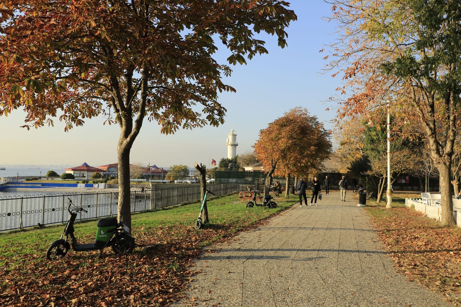
Leaving the ferry terminal behind, the route heads west along Barbaros Hayrettin Caddesi, a quiet asphalt avenue bordered by stone walls, century-old maritime pines, and nineteenth-century summer villas. This coastal stretch forms the western arc of the Burgazada walking route, delivering open views across the Sea of Marmara toward the neighboring island of Kınalıada.
- Exit the ferry pier and turn right along the waterfront, keeping the water to your right side as you pass the island fish taverns.
- Follow Barbaros Hayrettin Caddesi westward for approximately 1.5 kilometers as the residential lanes give way to pine woods.
- Veer right onto the beaten dirt trail marked by local wooden signs pointing down toward Madam Martha Bay.
- Walk down the natural stone steps to the pebble shoreline for a rest or a swim in the clear shallows.
- Rejoin the upper paved road and continue southwest along the forested ridge for another kilometer until the roadway ends at Kalpazankaya.
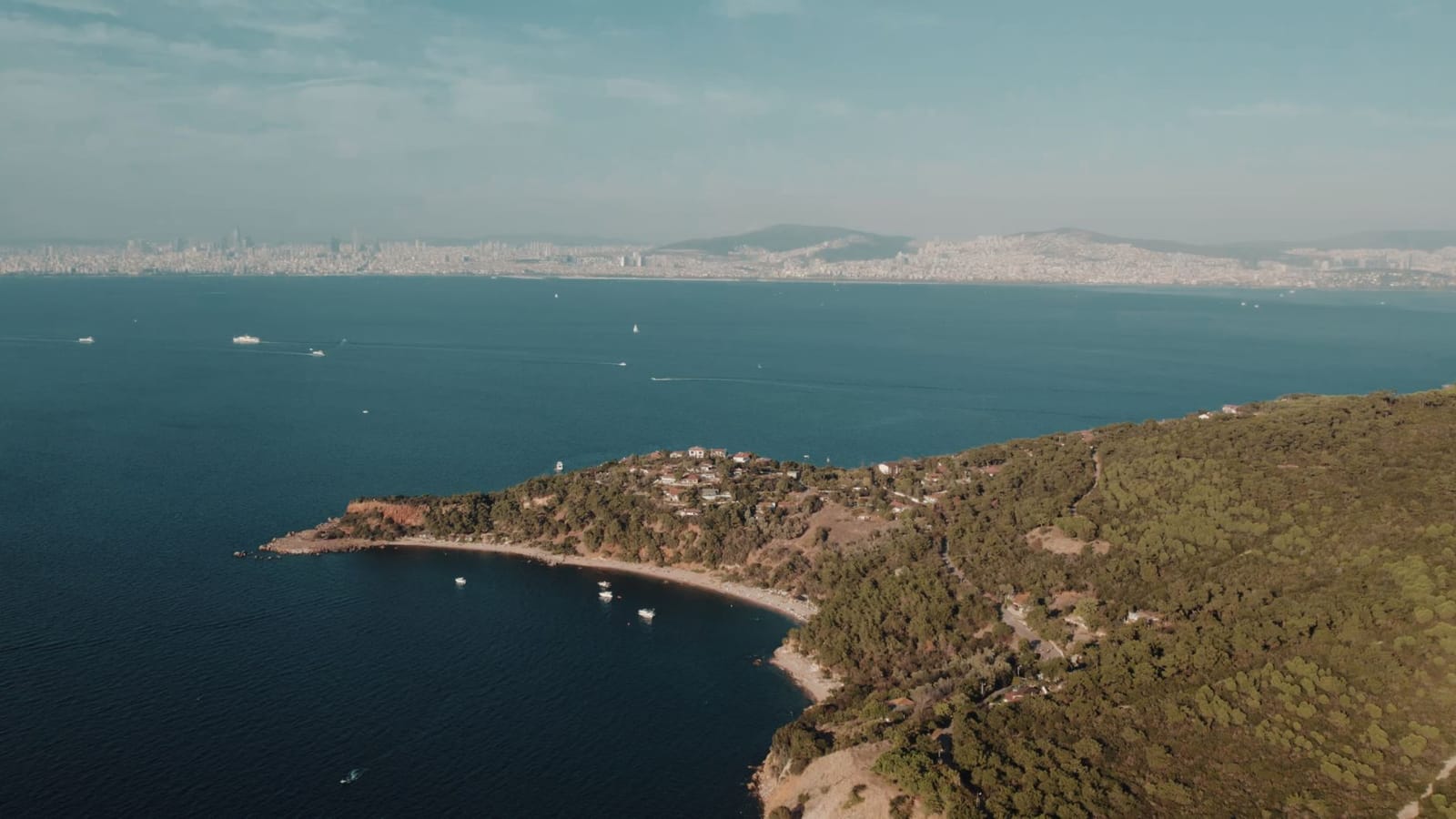
The trail drops steeply off the right side of the road into Madam Martha Koyu (Madam Martha Bay). Named after Martha Arat, a prominent mid-twentieth-century Istanbul ballerina who lived on the island, this curved pebble cove has clear water and a seabed rich in native seagrass meadows. Because the bay is classified as a Grade 1 Natural Protected Area, Istanbul authorities strictly prohibit wild camping and open fires.
Field Anecdote: When hiking the western path at 09:30 on a hot Tuesday, I tried cutting down an unmarked dirt trail toward Madam Martha Bay instead of following the official painted wooden signpost. The detour dropped me onto a steep bed of loose dry shale where my sneakers slid out from under me, resulting in scraped palms and a tedious twenty-minute climb back up to the road. Following the marked stone steps prevents that slide entirely.
Insider tip: Pack hard-soled water shoes in your daypack if you plan to swim at Madam Martha Koyu. The beach consists of smooth but sharp shingle stones, and sea urchins cluster on the submerged rocks roughly three meters from the shore.
Municipal forestry rangers regularly patrol the area and issue fines to anyone pitching tents beneath the pines. Day visitors are free to spread a towel on the pebbles, swim, or read under the trees, but you must carry all trash back up the hill because the cove has no municipal bins or public bathrooms.
Continuing past the bay, the road narrows and curves south along coastal pine ridges for another kilometer. The full distance from the ferry dock to the western point measures 2.5 kilometers and takes roughly 45 minutes of easy walking on a gentle uphill grade.
The path terminates at Kalpazankaya, a steep promontory above a rocky bay. The name translates directly to “Counterfeiter’s Rock,” referencing nineteenth-century outlaws who minted fake Ottoman coins inside the secluded sea caves beneath the cliff face to evade imperial police patrols. Today, an open-air restaurant operating here since 1959 occupies the bluff above the old caves, and municipal electric minibus line BU-1 departs from the turnout every 20 minutes back to the ferry dock.
Kalpazankaya dining, sunset timing, and late-night return ferries
Kalpazankaya Restaurant occupies the southwestern headland of Burgazada, where open-air terraces overlook rocky ledges and the silhouette of Kınalıada across the water. A typical dinner of cold meze, seasonal salad, and grilled sea bass costs between 1,100 TL and 1,500 TL (22 to 30 EUR / 24.50 to 33.30 USD) per person, excluding alcoholic drinks. Tables along the perimeter railing fill up early on autumn evenings, making reservations at least one day ahead necessary if you plan to eat during twilight. Before sitting down, walk down the stepped footpath beneath the dining platforms: the rocky outcrop below offers an unobstructed vantage point for watching the sun drop behind Kınalıada.
Berk’s Insider Tip: Do not rely on mobile data at the rocky water edge beneath Kalpazankaya; cell coverage drops behind the headland. Download your offline transit map or ferry timetable before leaving the village pier.
Returning to the harbor requires precise clock watching. You should allow at least 35 minutes for the 3-kilometer walk along the paved pine-shaded road back to the pier. The municipal Adabus electric shuttle stops near the restaurant turnaround and costs 158.35 TL (3.17 EUR / 3.52 USD) using an Istanbulkart, but late-evening runs become sporadic once dinner crowds disperse. If a vehicle is not idling at the turnaround, begin walking immediately rather than waiting for an unconfirmed arrival.
Managing your maritime departure is where evening plans on Burgazada usually face friction. The last regular Şehir Hatları passenger ferry bound for Kadıköy and Kabataş leaves around 21:30 during the autumn schedule. Missing this departure eliminates direct links to the European side. Your remaining fallback consists of private operators running Bostancı late boats, with Mavi Marmara engines departing Burgazada toward the Asian mainland until roughly midnight. If you dock at Bostancı late, our guide on Crossing the Bosphorus after midnight with 2026 night transport tips maps the night bus combinations needed to cross back over the bridges. The final confirmed boat departure from the island is handwritten on the Bostancı ticket booth window each afternoon.
Practical walking strategy and final departure checks
Burgazada works best on foot, free from the electric minibus queues and bike congestion that crowd Büyükada. Skip taking the municipal Adabüs shuttles up to Kalpazankaya; walking the perimeter road takes forty minutes at a steady pace, and you avoid waiting in a disorganized line at the central square. If you plan to eat near the water, bypass the row of fish taverns directly opposite the ferry dock, where service turns erratic whenever an arrival disembarks, and walk two blocks west along Gezinti Caddesi instead.
Before starting up the slope toward Çayır Sokak and the Sait Faik Museum, walk over to the printed Şehir Hatları timetable board posted beside the pier turnstiles and photograph the departure column for your return port. Transit apps frequently misreport seasonal timetable shifts between the mainland and the islands, and that physical printout is the schedule the ferry crew actually follows.